August 7, 200218°51.9'S, 159°48.1W
|
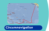
Aitutaki has taken us in. The arms of the lagoon have enfolded Pacific Bliss in its emerald seas, lapping at the hull during the gusts. The cheerful sun has beamed upon her here through azure skies. The cruisers anchored here--on CheckMate, Alii Kai, Infineon, Da Capo, and Red-have helped us anchor and get settled with an infectious friendliness. And the islanders have greeted us warmly wherever we have gone. Aitutaki is the northernmost of the lower Cook Islands, about 150 miles north of Rarotonga. It is fairly flat, with the highest point being Mount Maungapu at 119 meters (390'). The first European to anchor here was Captain Bligh in the Bounty, only two weeks prior to the infamous mutiny in the waters off Samoa. The first missionary to arrive here, back in 1821, was John Williams of the London Missionary Society. His church survives today as the Cook Islands Christian Church. From our anchorage, we can see the church he built in 1828-the white limestone now faded and blackened, but still functioning; we attended services there on Sunday. We first spotted Aitutaki at dawn last Saturday, hazy and green to our port as we sailed southwest from Bora Bora. WE had finally left French Polynesia after spending 3 ½ months there. Aitutaki was a welcome sight to three miserable crew-Gunter, Richard and I-who had endured a four-day passage with a mixed bag of weather: we had motored for 20 hours with no wind; flew the spinnaker for ½ day; then smacked into 2 days of strong 24-30 southeast winds and heavy southern swells, with a and a newly-issued strong wind warning. Fatigued from the passage, we still had to contend with navigating the tricky and shallow Arutunga pass, the only navigable channel through the island's reef. It leads to the small basin on the western side of the island, which we hoped would not be full. The pass had been blasted through the reef by the U.S. during World War II and dredged to 12 feet. Silt had now filled it in to current depth of 5.6 feet-that's at high slack water. Even with a Catamaran drawing less than 3' with the daggerboards up, we were worried. The pass, lined with coral heads on either side, was reportedly only 40 feet wide. Pacific Bliss is 24 feet. There would be no room for error. Charlie's Charts says, "the Port Captain occasionally monitors VHF 16 during working hours and vessels may enter and clear through this port of entry." I called, and received two or three immediate answers from cruisers in the basin. "It's pretty laid back here," they said. "Don't expect an answer from the Port Captain, and especially on a Saturday." But my call did mobilize the little cruising community of five boats. Not only was the entry tricky, but the anchorage itself was filled with rocks and coral heads, and only 3-6' deep in most places, they informed us. The wind had been a steady Force 6 all night, gusting to a Force 7. As we headed toward the pass, as luck would have it, the wind became a steady Force 7, blowing across our deck at close to 30 knots. Our sails were down and both engines on as we edged on in, attempting to follow the MaxSea electronic chart. The chart had beautifully detailed the pass, but when we tried to line up the two markers before and above the church roof, it didn't compute. (Our chart, it turns out, is at least ¼ mile off.) The instructions from the yachts kept coming in, and finally, Rick of Infinion came out with his dinghy to guide us in. Captain Gunter revved the engines full throttle forward, as we met the outflowing current in the pass head on. Richard and I directed Gunter to the center of the winding channel from the port and starboard pulpit seats at the bow. The yachts in the basin had pulled in their stern anchors so that we could wind on through to the front of the group-in the innermost part of the basin. We had to wind very close to the yachts and at one point we scraped sandy bottom 1.9 feet! We dropped the anchor in 6 feet; as I recorded the instrument data in the logbook, the depth registered at 3.6 feet. We set a stern anchor so that we wouldn't swing into coralheads if the wind changed. Then we cooked up our first hot meal in 2 1/2 days: fried potatoes, onions, eggs, toast and coffee. Satiated, we turned in to the deep sleep that only arrival in port can bring. By Saturday evening we had spruced up Pacific Bliss enough to have the crew of Infinion-Rick, Patsy and little six-year-old Jessie-over for a "thank you" sundowner. We were amazed at how much colder the evenings are here and dug for fleeces or jackets as we sat shivering in the cockpit. "We've come too far south," Gunter muttered. We are approaching 19° South, still in the tropics, but this is the middle of the Cook Islands winter! Venus came up early, bright as a cradle moon. The Southern Cross had wrested its way through the clouds. Sunday promised to be a brighter and better day, and it was. We hadn't seen a sunrise in a few days, so after the luxury of a full eight hours sleep without a watch, I photographed the sun shining on the yachts in our anchorage. Photo: A visit by Infinion-Patsy, Rick and little Jessie (to come)
Back to Log and Journal |
journal81.html |
|
|


